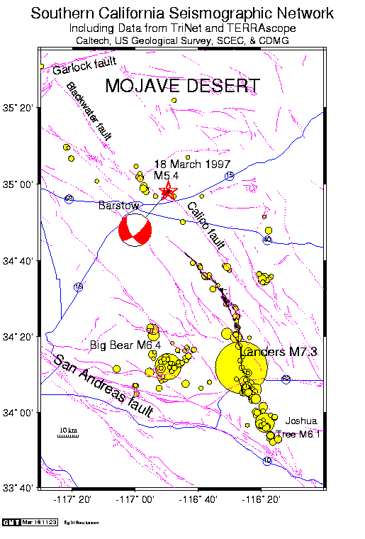
This map shows the location of the Calico Earthquake (red star), a Landers aftershock, on a background map showing seismicity of M>4.0 associated with the Landers Earthquake. The epicenters of these shocks are plotted using yellow circles, the size of each indicating relative magnitude. The focal mechanism of the Calico Earthquake is shown by the red-and-white "beach ball" symbol. It indicates that the quake was caused by right-lateral strike slip along the Calico fault.
Major highways are shown in blue and labelled. Surface traces of major faults are drawn in purple, and a few are labelled by name.
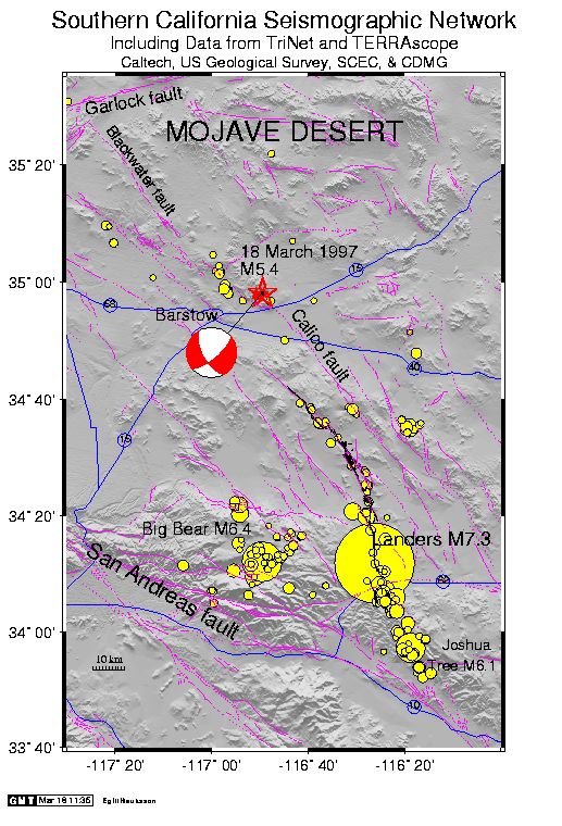
Calico Earthquake Map with local topography (205K GIF)