The March 11, 1998 Crafton Hills Earthquake
March 11, 1998: A magnitude 4.5 earthquake in southern
California at 4:18 a.m. PST Thursday morning March 11, 1998. It was
located in the San Bernardino Valley, 4 west-southwest of the city of Redlands.
It occurred at a depth of 14 km (9 miles) below the surface of the earth.
As of 2 p.m. March 11, no aftershocks had been recorded to this earthquake.
The earthquake was widely felt over southern California, as far away
as Thousand Oaks. The strongest shaking recorded at a TriNet station
in this earthquake was in Riverside, with a peak horizontal acceleration
of 96 cm/s/s, or almost 10% the force of gravity (see
ShakeMap)
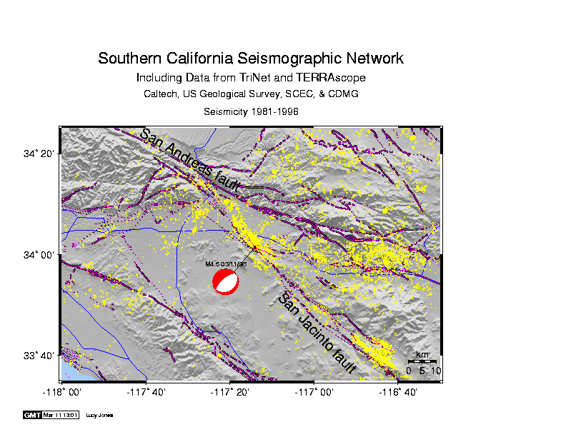
The earthquake was located near the intersection of the San
Jacinto fault and the Crafton
Hills fault . This is historically one of the sites of highest
microseismicity in southern California (see map below). The previous
largest earthquake in this region was a M4.8 at almost the same location
and also at 15 km depth that occurred in October 1985
The focal mechanism of the earthquake (the red ball in the map) indicates the
orientation of direction of the fault and in this instance, indicates a
normal fault.
The Crafton Hills is a normal fault, with a fault orientation consistent
with the focal mechanism and thus could have been the causative fault for
this earthquake. Because of the depth of the earthquake (14 km) compared
to its size (a M4.5 occurs over a fault area of less than 1 km), any association
with a fault seen at the Earth's surface must be tentative.